The Route - Days 2 & 3
Days 2 and 3 of the Coast to Coast Walk covers 24 miles from Ennerdale Bridge to Grasmere.
Day 2 - Ennerdale Bridge to Rosthwaite - 15 miles
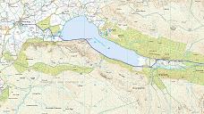
Stage 1 - Ennerdale Bridge to Ennerdale Forest
Ennerdale valley is one of the more remote and less walked valleys in the Lake District. The walk goes along the south shore of the lake and passes over a grassy headland called "Robin Hood's Chair".
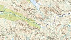
Stage 2 - Ennerdale Forest to Honister
A walk through Ennerdale forest to Black Sail Youth Hostel. In Alfred Wainwrights book, he describes how he was saddened when the plantations were established as he recalls how the valley used to be open fell side. There will be plenty of photo opportunities from this valley, with Pillar and Haystacks dominating the landscape. This section of the walk also includes what is probably the steepest ascent of the walk, ascending over 1000ft in just less than 1 mile.
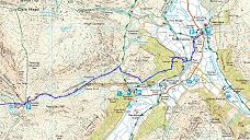
Stage 3 - Honister to Rosthwaite
The main landmark on this stretch of the walk is the Honister pass and slate mine. From Honister the walk enters the Borrowdale valley. This is my favourite part of the Lake District with many family holidays spent in a farmhouse in the village of Grange.
Google Earth kmz for Day 2
Day 3 - Rosthwaite to Grasmere - 9 miles
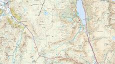
Stage 1 - Rosthwaite to Moment Crag
The route between Rosthwaite and Grasmere is more or less a south easterly direction. The path takes in the impressive view of Calf Crag
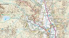
Stage 2 - Moment Crag to Grasmere
The descent into Grasmere will be via a ridge walk that ends at Helm Crag. From the top of Helm Crag there is a a full panorama view that includes Helvellyn and Blencathra as well as a view over Grasmere.
Google Earth kmz for Day 3
Click here to download Google Earth and use the kmz files to fly through an animation of the route. Information on the Google Earth Touring feature can be found here.
- Day 1
- Day 2 & 3
- Day 4 & 5
- Day 6 & 7
- Day 8 & 9
- Day 10 & 11
- Day 12 & 13
- Day 14